Posts

Showing posts with the label bike camping

Journey to the center of North America: part 8

Image
Way back in July 2010 the Man of 3 Names and I set out from Grand Forks, ND on bicycles to sojourn to the Center of North America (Rugby.) I do not recall much from this part of the trip except my rear tire was causing me problems endlessly. However, now the conclusion of our journey. Barn in ND countryside Waking in a hotel was not my intention but it felt good. Moreover they did have breakfast- and what the construction workers did not devour earlier in the morn, I ate. I think 3 Names had some too but I am not sure. Before heading out we stopped at K-Mart a picked up a patch kit for my tire. They did not have a replacement tube for a 700x35 presta. Back on US-2 we made good time until I had another flat. I repaired the flat next to a round bale and we were on our way again. The shoulders were wider this side of Devil's Lake but the traffic was much heavier. We lunched in Michigan City and I noted that they grocery store was part of a complex that included a c...

Journey to the center of North America: Part 7

Image
Way back in July 2010 the Man of 3 Names and I set out from Grand Forks, ND on bicycles to sojourn to the Center of North America (Rugby.) It has been while since I have written about it so the details will be sketchy, but I felt I needed to complete this one before I move onto the latest bike trip.    Near Rolette, but not quite  Here are the previous posts for you to catch up on Part 1: Leaving Grand Forks Part 2: Towards the border Part 3: From Hoople to Walhalla Part 4: Out of the Gorge and a change of plans Part 5: Independence in Munich Part 6: Night at the Hawk Museum I continue this story as we leave the Hawk Museum and head towards the center of North America in Rugby.  Old farm machinery  I cannot say enough about the Hawk Museum camp we made. It was cool. We were surrounded by tons of old iron. There was a shower. And it was cheap. I think we may have paid just $5 for both of us. What a deal! With still a chill...

Journey to the center of North America: Part 6

Image
Way back in July 2010 the Man of 3 Names and I set out from Grand Forks, ND on bicycles to sojourn to the Center of North America (Rugby.) I continue this story as we head west towards our destination and spend the night amongst old things. It was a bit chilly the morning of July 5th. Dew had settled upon our tents. The bathrooms were still closed. We ate a bit then torn down camp. We stopped at the local watering hole to use the facilities before heading out. By then the sun had come up and it was getting a bit warm.  What we failed to realize was Munich was the birthplace of Quentin Burdick, former Senator of North Dakota. No plaque enlightened us to this fact. We headed south a bit then west along a rail road which happened to hold a lot of rolling stock. Not sure why these cars were stored here but we encountered quite a few spots along the tracks where there were a mile of cars.  We passed Calio which just looked like one big farm. We stopped at Egeland to have a rest. ...

Journey to the Center of North America: Part 5

Image
Way back in July 2010 the Man of 3 Names and I set out from Grand Forks, ND on bicycles to sojourn to the Center of North America (Rugby.) This is the continuing log of that eventful journey. We left off as 3 Names and I descended upon Langdon along Highway 1. We arrived in Langdon about dinner time on July 4th. I stopped at the local grocery before it closed to get some food, including 1/4 of a watermelon. Afterward we rode to a local park to rest and eat and fill up on water. The park was deserted but had water and restrooms and if we so desired we could have camped there for $10. Not bad, they even had cable TV hook-ups. However, I wanted to make it a bit further today so we pushed on. Upon leaving town we encountered an obstacle which we would meet many times- farm dogs. This dog put up a good chase. We needed to push ourselves over 25 MPH in order to escape and even then the dog nearly kept up. Once that ordeal passed, we co...

Journey to the center of North America: Part 4

Image
Way back in July 2010 the Man of 3 Names and I set out from Grand Forks, ND on bicycles to sojourn to the Center of North America (Rugby.) This is the continuing log of that eventful journey. Part 3 left off  with 3 Names and I at a crowded campground in Wahalla on the evening of July 3rd. I finally got to sleep after the pre-Independence Day racket died down in the wee hours of the morn. We awoke, ate a little breakfast, filled up on water, then began our trek to the Pembina Gorge west of town. The wind was against us as we made our way up the first hill traveling out of Wahalla, but it was warm and I did not mind it much. Now the Pembina Gorge is unlike any other place in North Dakota except perhaps the Badlands. Most of eastern North Dakota is flat prairie but the Pembina Gorge region is hilly and wooded. An ancient and much larger iteration of the Pembina River of today carved out the gorge. Once the edge was reached we descended quickly reaching speeds of 40 MPH along t...

Journey to the Center of North America: Part 3

Image
The heat did not dissipate after leaving Hoople. Fortunately, I found a water spigot in Tatertown to refill my reservoir. The 18 miles of long straight road into Cavalier was generally uneventful. It was mostly fields of potatoes and an occasional farm house and barn. The Man of 3 Names and I arrived in Cavalier pretty exhausted. 3 Names sat a spell in a gazebo on the edge of downtown while I sought out a grocery store. I couldn't find it and it may also be closed. Unfortunately, I have found small town North Dakota generally closes up around 5 or 6 with the exception of bars and maybe a convenience store. We found nourishment at a convenience store. I supplemented my 20 oz Mountain Dew Voltage with a burger from the nearby Pit Stop Diner . The Pit Stop appeared to be a locally owned eatery featuring burgers, dogs, fries, and ice cream that operated out of a property that may have been a Dairy Queen in the past. After a long day of biking anything tastes good and I gobbled down t...

Journey to the center of North America: Part 2

Image
Prairie Chicken WMA wasn't much to crow about. It just provided us with a small spot to camp. Not recommended but for the most hard core of bike tours. After eating one of the many oatmeal creme pies that the Man of 3 Names brought, I eagerly loaded up the bike to blow this WMA. It was almost blistering hot last night and the bugs were very thick. It was a pioneer experience. We discovered just before we left that a majority of the flatland grass good to camp upon was on the other side of a "moat." that surrounded most of this land. We were on a slice of land a few feet from the "moat." At night the discovery of unexpected water makes one stop. For all we knew it was one large wetland. Tip: Do not camp on wetlands, you will regret it. We hopped back on US 81 and pedaled north going through Ardoch, Minto and stopping in Grafton to eat and seek out the means to fix 3 Names' rack. While traveling I thought of some songs to go with the towns a...

Journey to the Center of North America: Part 1

Image
I finally am getting to writing about my bike trip a month after it happened. As usual it will come in installments. Hopefully you'll enjoy my adventure I took with the Man of 3 Names. Early in June, or May,  I got an e-mail from the Man of 3 Names. He wished to join me on my annual bike jaunt if it was OK. It was. I left most of the the route planning to him since he had much more time than I and excelled at planning. In fact he could have won a gold medal in planning if he hadn't gone into landscape architecture. 3 Names set out a tour through Northeastern North Dakota that would pass through Pembina Gorge, the Turtle Mountains, stop by the International Peace Garden, and then go the geographical center of North America in Rugby. We discussed a train option that would reduce some time on bikes but Amtrak didn't support us. No baggage stops or something in Rugby. On the evening of July 2nd we set out from Grand Forks. We got a rather late start by most standards mo...

Now off the bike

Image
The next few weeks you'll hear about my incredible journey that took me just over 400 miles on a bicycle in 5 day in North Eastern North Dakota. To the left you can see how the trip ended for me. But I am not giving anything away.

Tour de Valli: Stage 8 return home

Image
At long last the final installment of the bike trip I took in July. N ot sure when I awoke in the Hunter park, but I did and embarked to points north. Points north, you ask? Yes. North is not the way home, but I wanted to add more mileage and the world's tallest structure was just along the way south of Blanchard. The tough part about seeking this tower out is that it is pencil on the horizon and only a few miles removed from the 2nd tallest mast in the world. Yep. The 2nd tallest tops off at 2060. So the masts can be hard to identify especially if you don't know where Galesburg is compared to Blanchard. (answer: Galesburg is SW of Blanchard.) I snapped a few photos and road onward. Moreover, as I now discover, the KVLY mast no longer holds that distinction of tallest structure. Some skyscraper in Dubai beat the tower's 2063 feet by a little over 600 feet recently. So now it is just the tallest mast I guess. However, when I saw the tower it may have still been the tallest s...

Tour de Valli: Stage 7 to Hunter

Image
The following is the continuing narrative of my North Dakotan bike tour in early July. I stuck around the Sibley Crossing Campground long enough to shower. It was Sunday. A slow day for some. The beach was littered with debris from last night's fun. You could have made a bonfire from it. After the cleaning ritual and packing I set out across Ashtabula. A paper handbill stuck out to me at the campground office the other night. It was for a restaurant that offered a Sunday brunch. The establishment, Kelly's Crossing, was on the other side of the lake at the east crossing. Hunger drove me to take the shortest route on gravel through the wind farm in the late morning heat. The wind turbines seemed to go on for miles. That morning only a few the giants were turning. Because of the emptiness of the range, the wind farm resembled something from a post apocalyptic novel. I was peering upon the last energy reserves of a once great society. Alas, that's not true. The jaunt through t...

Tour de Valli: Stage 6 to Sibley Crossing

Image
The following in the continuing narrative of my solo bike tour in North Dakota in early July. It was July 4th. It never seems special anymore since I am usually on the road to somewhere. Well, last year I was actually at a celebration at a friend's homestead. I even met up with a rock star that evening. Today I met a motor cycle couple from Iowa. They had pitched camp next to me at the campground. We talked a little about biking. They mentioned RAGBRAI , a popular (if not legendary) tour in Iowa from the Missouri to Mississippi River. I had read about it a number of years ago in Outside magazine. We also discussed the flooding in Fargo and in Iowa. After chatting I headed to the actual Pioneer Village next to the campground. This collection of old buildings with associated antiques is quaint and free. There was even a building they called "Louis L'Amour Writer's Shack," which featured artifacts from the prolific author's original hovel for writing. If you di...

Tour de Valli: Stage 5.5 In Jamestown

Image
Being larger than I expected, I was a bit disorientated once I got into the downtown. The James River, which runs through town, had flooded this spring and dikes were still standing. The James apparently is the longest un-navigatible river in the world . At least that's what the wiki says. I think you could probably canoe many of the 710 miles. I wanted to get a camping spot firest and then look around town. However, I ended up looking for a camping spot not knowing where I would find one. I had originally planned to camp at a primitive place north and west of town but I too scant notes to be able to find it. I tried a city park, McElroy Park. I went further east. No go. I used the Nuvi and it began to take me west. I climbed another hill, passed the Super Wal-Mart, then got directed down a dirt road where I proceeded to wipe out fall over the front handlebars due to the new gravel. I wasn't hurt, but frustrated. I continued down the road until it turned into a prairie road. Th...

Tour de Valli : Stage 5 to Jamestown

Image
This is a section of the continuing saga of the Tour de Valli, a solo journey on 2 wheels in North Dakota that was taken in early July 2009. Stage 5 begins in Valley City. I am unsurprised to learn that the previous evening I slept on a railroad bed. This certainly explains the difficulty in trying to stack out the tent. However, for $7 I am not arguing since it included a decent shower. Valley City is noted for its bridges and so after grabbing a bite to eat at the grocery store I set out exploring on foot. Of the 8 bridges (pdf file) I saw about half. The photo above is the bridge unto the Valley City State University campus (Alma mater of The Champ.) I poked around the empty campus and then pack through the city park. Later in the morning I packed up and discovered another grocery store (Lever's) which was closer than the other. Then looked through the library to find a North Dakota map gazetteer. The overwhelmed library did not. At noon I decided to take lunch at the Pizza Hit...

Tour de Valli: Stage 4 - To Valley City

Image
This stage turned out to be the longest and hotest. Due to not being a direct paved route from Mapleton to Valley City, I needed to head north to get on a western route. It did not prove to be easy as you will see. Got up early. About 7ish. No problems in Mapleton. I suppose the train traffic could be thought as being a problem as it was about 300 yards from my tent. However I have found that to be a sound of security. Still, train traffic was plenty high the course of the night. I found the actual city park on the other side of town. It was tucked in the middle of a residential development. Soon, I met up with the first sign of route problems. The road heading north out of town was closed for construction. And it was impassable. I searched for another road north to no avail. Reluctantly, I headed south to the Interstate in hopes of finding a westbound road. Providentially, there was a paved frontage road on the south side of the Interstate which I took all the way to Casselton. I stop...

Tour de Valli: Stage 3 - To Mapleton

Image
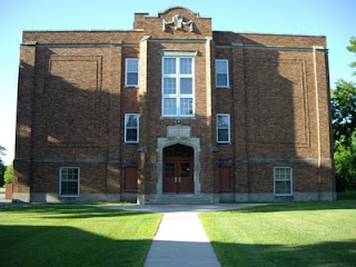
Leaving work a little later than I anticipated and not having nearly everything packed, I started much later than I desired. Fortunately the days are long and I had adequate night illuminations on the bike. I also did not get any supper. Still, I strove on west on US-10/94 Bus to West Fargo. I then proceeded north and missed the turn to go towards Mapleton. Fortunately it was not by much. I had never been out this way before but it was some good biking. The weather was perfect and the moon was almost full. Mapleton is a short jaunt from the start but provided an excellent stopping off point for the evening. I doubt could have hustled 40 miles to Arthur or even Tower City. According to my research there was primitive camping at Mapleton City Park. However, I had no clue which of the 3 "parks" they were referring. I set up camp beyond a ball field in some trees and retired for the night. The picture is of the Mapleton School, just a few blocks from my campsite.

Tour de Valli : Stage 2 - the route

Image
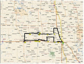
This year the tour's goal was to head West. Some may have suspected Medora to be the grand terminus but alas it ended up being someplace else. From the start, finding a western route was difficult. Outside the metropolis, paved roads heading west were rare or took one too far north or south to be of any value on a 5 day tour. With numerous maps I pored over possible routes. The Interstate was out of the question although bikes are allowed on the shoulder. To me that would be boring. Eventually I found a route that took me through Mapleton to Casselton and unto Valley City and then to Jamestown. I printed some reference maps and packed my Nuvi. July 15- Added the map and now realize I could have called the tour "The Hammer" but refrained from wearing the baggy pants.

Tour de Valli: Stage 1 - Gear

Image
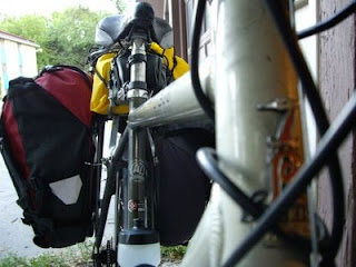
The gear is the unsung hero on the self supported bike tour. It does its job and that is that. It never gets the plaudits like bike- until now. (Of course let's hope this jump starts manufacturer sponsorship points.) The indispensible gear Ortlieb Pannier- That's right, singular. I only have one Ortlieb I picked up at REI scratch and dent sale years ago. I had another pannier on this our, a Deuter, but I was able to resurrect the Ortlieb after finding the missing part online I had lost years ago. Back in those dark days Ortlieb didn't respond to my cries for the part. I really should get another one because the size and durablity are incredible. Did I mention it is waterproof? Bontrager Bar Ends- I added these to the bike because on the previous tour I must have placed too much pressure on my Ulnar nerve and had 2 tingling fingers for over a month afterward. The bar ends provided a few more hand positions to avoid this. I also got better gloves. Euro Team Cycling Cap- I p...

Biking the Sheyenne Valley

Image
T his year's solo bike adventure took my from my front door to the Sheyenne River Valley. Not wanting to spend much on gas money I loaded my bike and trekked southward from the Go on country roads. Some would say this was a physically challenging endeavor. Few of my peers have biked more than 20 miles at 1 time. This whole trip may have been near 200 miles. I didn't keep accurate data but I knew I was making over 40 miles a day. The challenging part of this trip was mental. The boring terrain of a large portion of the places I biked wore me out. In order to stay somewhat sane I stopped at country cemeteries and the read the stones. However, the Sheyenne River Valley is magically unlike any parts of Eastern North Dakota. I followed the scenic route from the Little Yellowstone Park to Lisbon and was impressed with all but the last 5 miles. Some frustrations of this trip also included a poorly vented bivy tent. This tent was like sleeping in a coffin. I'm glad I had a mini fan...

It was not swimming

I took an abbreviated bike camping trip this Labor Day weekend. I could regret it but instead I will look on the bright side. Rainy, rainy, rainy. I should have gone elsewhere. It rained the morning I left. It rained when I arrived. It appeared it would rain again as I left the Chippewa . Usually when I do this kind of camping it is dry. An occasional shower may pass but mostly the time in the wilderness is dry. Challenging as it became, I did enjoy the adventure. For one I did not like the established campsite- too close to people. I continued down the trail on my bike. I rode up some incredible steep inclines and had a scare going down since my brake pads were wet. Then a marsh consumed the trail and I had to seek for shelter as rain increased in volume. Well, I found a spot off a game trail and immediately improvised a shelter then tried to keep most of my supplies dry. I succeeded at only the former. It rained steady into the evening. Only once did the rain let up enough...